Svojkovice na Moravě and Želetava, Jihlava dist., Vysočina Region
Medieval mining area and settlement
(13th–15th cent.)
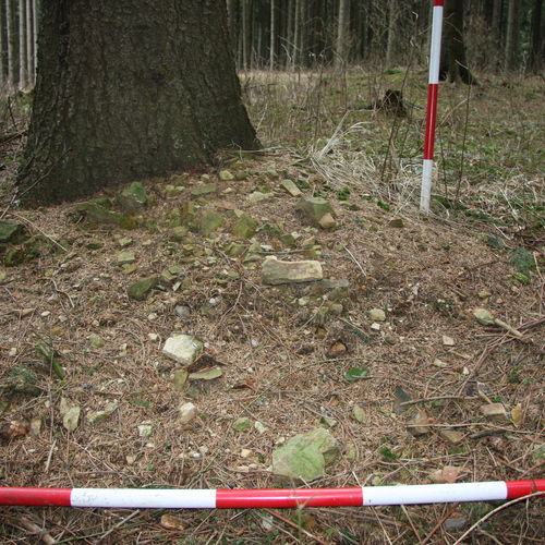
The vast deserted underground-mining and settlement area near Svojkovice and Hory represents a complex area engaged in mining and processing of the raw material. Apart from the remains above-ground in the cultural landscape, also some underground parts of the mine have survived. In the centre of this area lies Hrachová hora, with two preserved large pinge fields and one solitary pinge. The pinges, mostly of a circular or oval shape, are well visible in the ground, up to 3 m deep, sometimes surrounded by slag heaps. The village of Velké Štítky was situated about 800 m south of the mound. Mining started at the beginning of the 14th century, and written records claim that the village was deserted already in 1519, and subsequently the new village of Hory was founded nearby. In Štítky, we can still see the surface of a small circular fortification surrounded by a double ditch and an earthwork.
References: Nekuda 1961; Měřínský 1977, 1978, 1984; Nekuda – Unger 1981; Merta 1984; Houzar – Škrdla – Vokáč 2007.
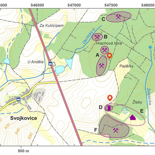
Navigation point: N 49°10‘12.17“, E 15°38‘58.10“ (pinge field north from the Hrachová Mounatin).
Map notes: A – pinge field on the south-eastern slope of Hrachová Mountain; B – solitary pinge; C – pinge field north of the peak of Hrachová Mountain; D – fortification/ruins of a fortified manor; E – village; F – remains of other line of pinges. Map symbols are available in the Downloads section.
Selected fulltext articles and reports for further reading. Complete bibliographical records are available in the Downloads section as the List of publications.
Sto zajímavých archeologických lokalit Moravy a Slezska – Svojkovice na Moravě a ŽeletavaHouzar, S. – Škrdla, P. – Vokáč, M. 2007: Mineralogie zlata z aluviálních sedimentů malých vodních toků mezi Želetavkou a Opatovem na západní Moravě, Acta rerum naturalium 3, 1–10.pdfMěřínský, Z. 1978: Povrchový průzkum na zaniklé středověké osadě Štítky u Svojkovic (okr. Jihlava), Přehled výzkumů 21, 95–96.pdf


