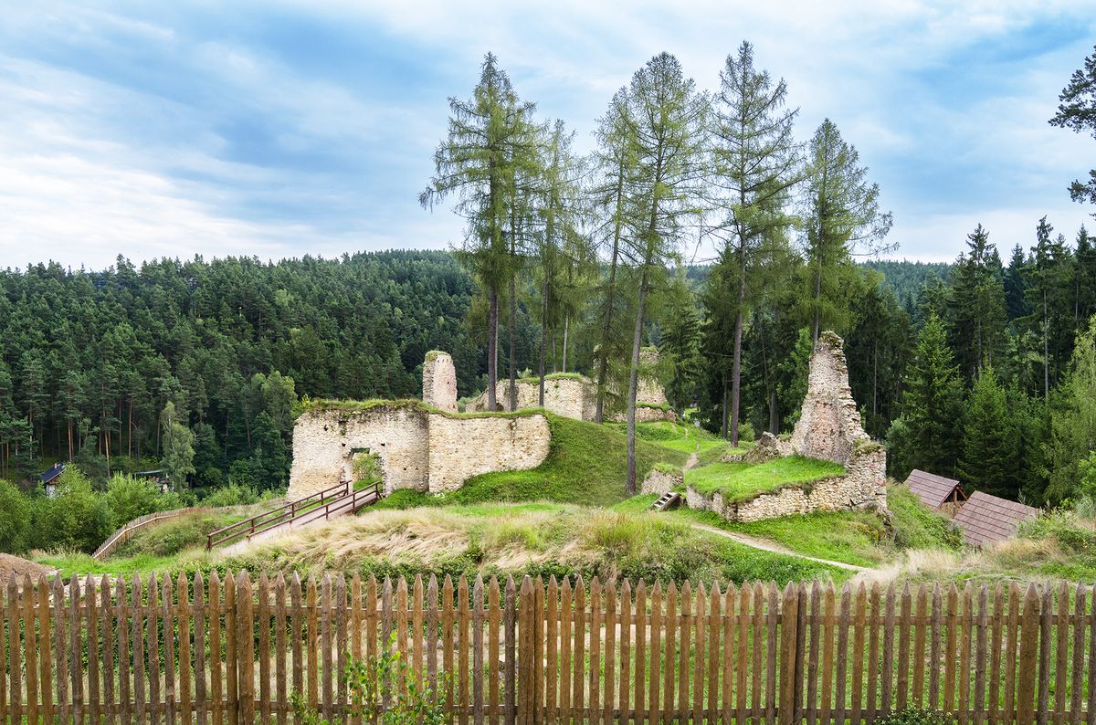
Pořešín, Český Krumlov dist., South Bohemian Region
Medieval castle
(13th–15th cent.)

Deserted mining area in the castle's foreground.
Photo. Z. Kačerová, 2014.
Extensive ruins of the Castle of Pořešín, with adjacent areas of a production character. Built at the end of the 13th century, the castle enjoyed its heyday and greatest reconstruction under Markvart I in the second half of the 14th century. In the first half of the 15th century, the castle was damaged and burned by Oldřich of Rosenberg (Rožmberk), an event that remains evident in the masonry to this day. The castle was originally dominated by a keep; later construction was concentrated around the curtain wall, despite the fact that the keep was still standing. Preserved in the vicinity of the castle are a millrace, stone quarries and a limestone kiln.
References: Menclová 1972b; Sedláček 1994; Durdík – Sušický 2002; Durdík 2008, 2009.
Navigation points: N 48°46'33.44", E 14°30'28.91".


Map notes: A – castle; B–C – baileys; D – keep; E – two-compartment palace; F – tower gateway; G – remnant of stone structure; H – platforms left after above-ground structures; I – mouth of the third ditch, later protected by a wall; J – defensive wall around the centre of the castle; K – buildings attached to the wall; L – third gate; M – kitchen; N – stone bridge support; O – building, the upper floor of which was insulated by a wattle construction; P – quarries for building stone; Q – hollow ways; R – remains of a limestone kiln; S – remains of a millrace. Map symbols are available in the Downloads section.


Selected fulltext articles and reports for further reading. Complete bibliographical records are available in the Downloads section as the List of publications.
Archeologický atlas Čech – Pořešín