Hradišťko I, Kolín dist., Central Bohemian Region
Svatovík: Early medieval lowland fortified settlement
9th–12th centuries AD
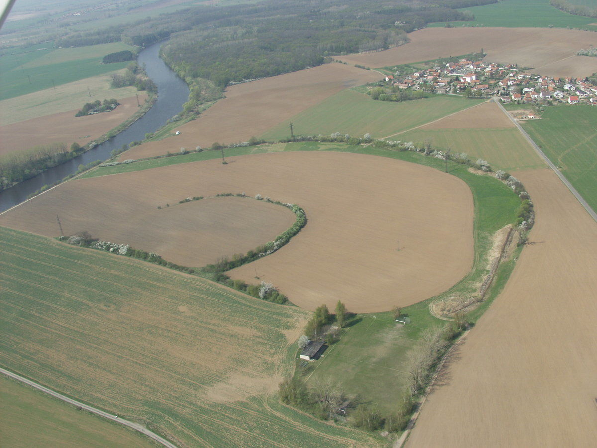
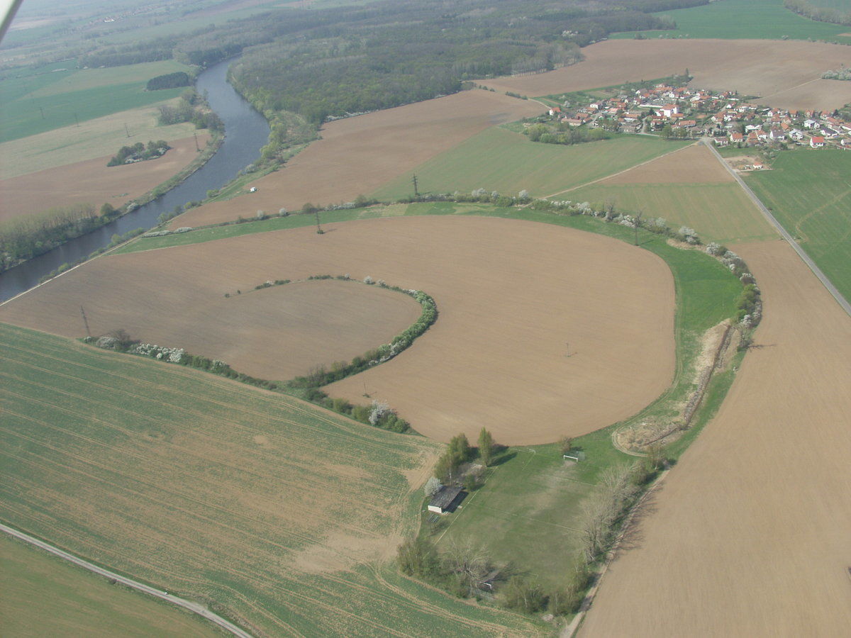
The aerial view shows the river meander surrounding the outer bailey.
Photographic Archive of the Institute for Archaeological Heritage of Central Bohemia.
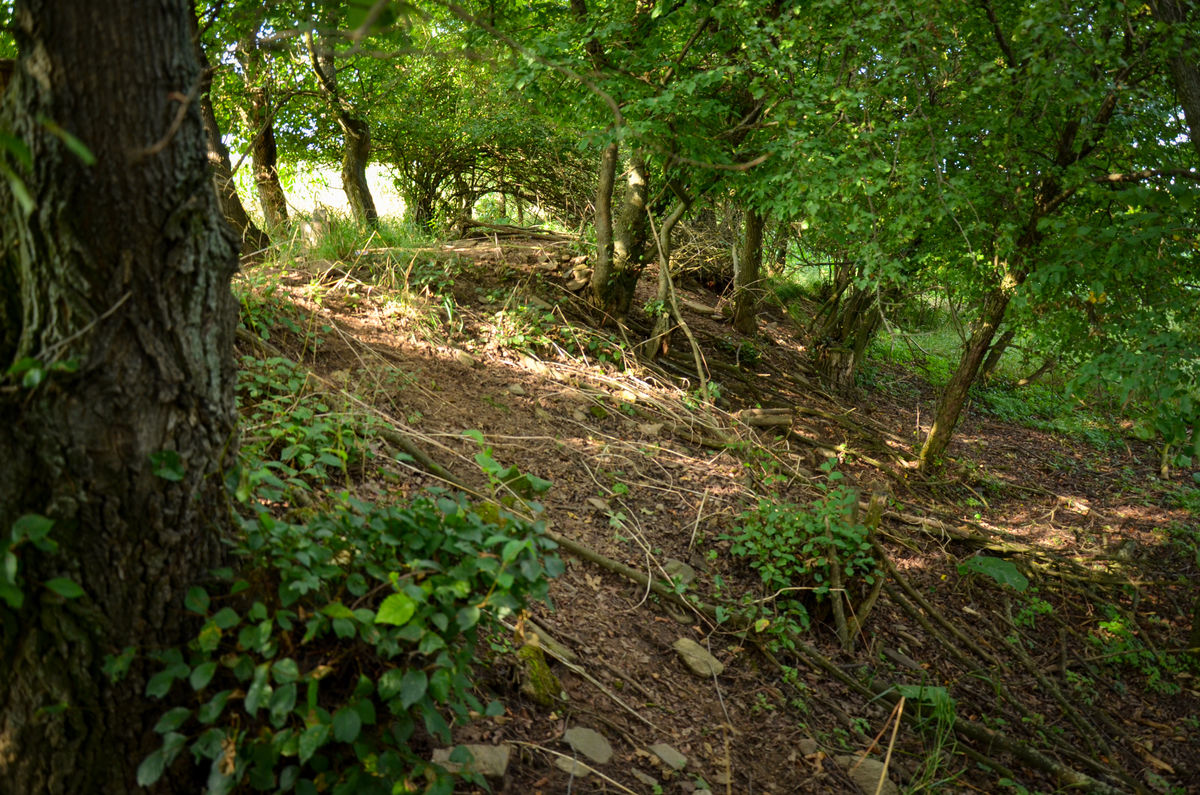
The fortified settlement of Svatovík lies near the village of Hradišťko I in the fertile Elbe Lowland. It is situated approximately 3 km north of Kolín, on the right bank of the present-day River Elbe. Thanks to its surviving ramparts, numerous archaeological finds and clear association with the former river landscape, it is one of the most prominent sites of its type in the Middle Elbe Region.
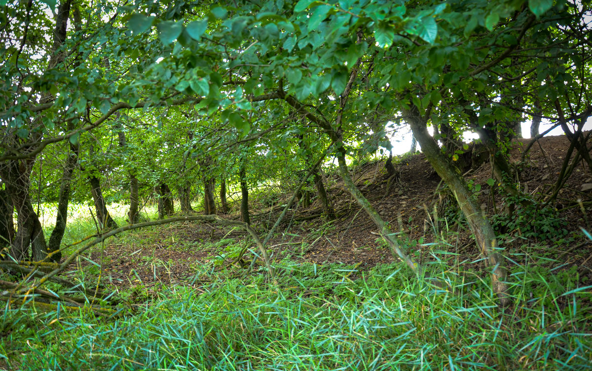
The settlement covered approximately 2.3 ha and was enclosed by a fortification around its entire perimeter, with an additional ditch on the western side, where access was easiest (A). A former river meander, still discernible in the landscape, surrounded the fortified settlement and its adjoining outer bailey on three sides. Together, these areas covered 5.2 ha, and the river channel itself also provided a natural line of defence (B). In 1898, trial trenches excavated along the southern side of the rampart revealed a stone wall 2 m wide, which still stood 1 m above ground level and extended to a considerable depth.
Several archaeological investigations have been carried out at the site. The first took place in 1889–1890, led by J. L. Píč and J. Hellich, followed by another in 1962, conducted by M. Richter. In 1990, a rescue excavation led by J. Hrala and Z. Sedláček uncovered a dense concentration of features and graves. These investigations revealed at least 24 settlement features in the outer bailey, dating predominantly to the 10th and 11th centuries. These included semi-sunken huts measuring approximately 3 × 3 m to 4 × 5 m, with wattle walls coated in thick layers of daub. Remains of stone ovens or open hearths were found in the corners of some dwellings. Other excavated features included storage pits used for grain and refuse pits. At least 13 inhumation graves were also identified in the outer bailey. Their stratigraphic relationship with the settlement features indicates that the site was used over an extended period and underwent successive changes in function. The finds are dominated by pottery characteristic of the Late Hillfort period, decorated with distinctive wavy lines and horizontal grooves. Important finds also include imported pottery from the Prague production area, providing evidence of the settlement’s wider contacts. Other discoveries include ceramic spindle whorls, bones of domestic and wild animals, and a silver denier of Duke Boleslaus II (967/972–999). A group of antler blanks is also noteworthy, as these may represent waste from a craft workshop.
Svatovík is not an isolated archaeological site in this area. Approximately 1 km to the south-east lies the Hradišťko sand quarry, where extraction revealed evidence of settlement and burial activity dating from the Bronze Age to the Early Middle Ages (C). Another early medieval settlement is known further to the east (E). Around 2 km to the south lies an extensive multi-period site, which also provides evidence of early medieval burial practices (F). A prehistoric cemetery dating to the Bronze Age and Hallstatt period has been documented north-east of Hradišťko (D). On the western outskirts of Kolín, at the site of the present-day I/38 road, geophysical survey identified the south-eastern part of an exceptionally large Neolithic rondel, with an outer diameter exceeding 200 m (G). The importance of the wider region during the 9th and 10th centuries is further emphasised by the nearby centre of Kolín and the discovery there of a richly furnished princely grave. It is also worth noting that Hradišťko lay on a long-distance route running from the important centre at Kolín towards the hillforts at Libice nad Cidlinou and Stará Boleslav.
References: Píč 1892; Knor 1942; Šimek 1942; Richter 1962; Kudrnáč 1963; Hrala – Sedláček 1990; Mazač – Jouza 2006; Forst 2010; Mařík 2013.
Navigation point: N 50°3'37.62", E 15°10'54.15" (entrance to the outer bailey near the football pitch).
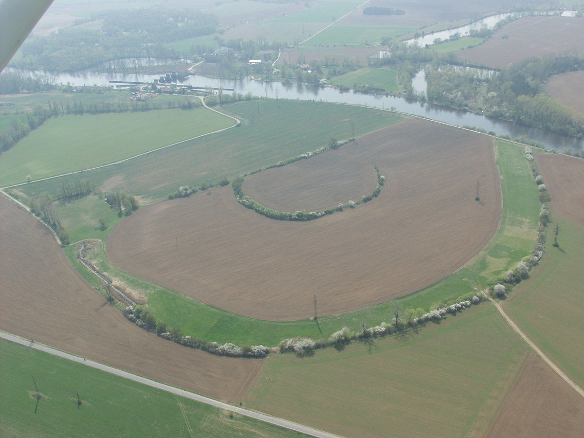
Map notes: A – Svatovík fortified settlement; B – outer bailey; C – cemetery (Bronze Age and Iron Age) and early medieval settlement; D – cemetery (Bronze Age and Iron Age); E – early medieval settlement; F – multi-period site with settlement and burial activity (Palaeolithic, Neolithic, Eneolithic, Bronze Age, Iron Age and Early Middle Ages); G – Neolithic circular enclosure (Stroke-Ornamented Ware culture). Map symbols are available in the Downloads section.


Selected fulltext articles and reports for further reading. Complete bibliographical records are available in the Downloads section as the List of publications.
Forst, M. 2010: Hradišťko I. Raně středověké nížinné hradisko u Kolína [online]. Dostupné z: https://is.muni.cz/th/s9ktz/bkl.pdf Hrala, J. – Sedláček, Z. 1990: Hlášení o záchranné akci – Hradišťko I a Veltruby. Dokument C-TX-199003580. Regionální muzeum v Kolíně, p. o. Dostupné z: Digitální archiv AMČR https://doi.org/10.60585/C-TX-199003580Knor, A. 1942: Hradišťko – „Na hradišti“. Dokument C-TX-194202569. Archeologický ústav AV ČR, Praha, v. v. i. Dostupné z: Digitální archiv AMČR https://doi.org/10.60585/C-TX-194202569Richter, M. 1962: Zpráva o záchranném výzkumu Hradišťko u Kolína. Dokument C-TX-196207212. Archeologický ústav AV ČR, Praha, v. v. i. Dostupné z: Digitální archiv AMČR https://doi.org/10.60585/C-TX-196207212Šimek, E. 1942: Hradiště u obce Hradišťka u Kolína, ochrana. Dokument C-TX-194202511. [jiná organizace]. Dostupné z: Digitální archiv AMČR https://doi.org/10.60585/C-TX-194202511