Česká Cikánka, Žďár nad Sázavou distr., Vysočina Region
Prehistoric and early medieval hillfort, medieval castle
(750–400 BC, from the 2nd half of the 10th cent. to the 14th cent.)
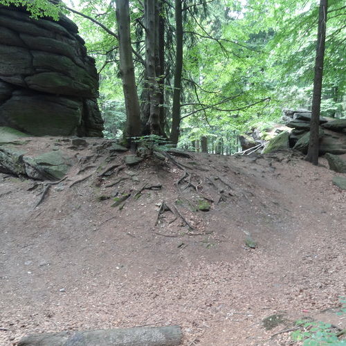
The multi-cultural site of Zkamenělý zámek is situated amidst of the forested landscape of the Bohemian-Moravian border and has been known since the end of the 18th century. The first archaeological finds can be dated to the Neolithic. A modest hillfort belongs to the Hallstatt Period and Early Middle Ages. It was erected on a partially split rock, formed of magmatic gneiss in the middle of a long ridge. It was encircled by a double ditch, which was incorporated into a fortress in the 13th–14th centuries. Specific for the site is the use of large boulders and a good state of preservation of the defence features.
References: Adámek 1902; Frolík 1979; Frolík 1985; Čtverák et al. 2003.
Navigation point: N 49°42‘32.62“, E 16°04‘28.61“ (entrance from the north).
Map notes: 1 – outer moat; 2 – inner moat; 3–4 – earthworks; 5 – shallow ditch; 6 – entrance to the upper ward; A, C – area between the rock formations; B, D, F – boulders; K – 'zkamenělá věž' (petrified tower). Map symbols are available in the Downloads section.
Selected fulltext articles and reports for further reading. Complete bibliographical records are available in the Downloads section as the List of publications.
Sto zajímavých archeologických lokalit Moravy a Slezska – Česká CikánkaAdámek, K. 1902: Hradiště Zkamenělý zámek u Hlinska, Památky archeologické XIX/1900–1901, 27–42.pdfFrolík, J. 1979: Pravěké nálezy ze „Zkamenělého zámku“ (k. ú. Svratouch) u Hlinska, Zpravodaj Krajského muzea ve východních Čechách IV/1, 91–93.pdf


