Uherské Hradiště, Uherské Hradiště District, Zlín Region
Early medieval sacral centre and settlement area of Sady
(8th/9th–13th century)
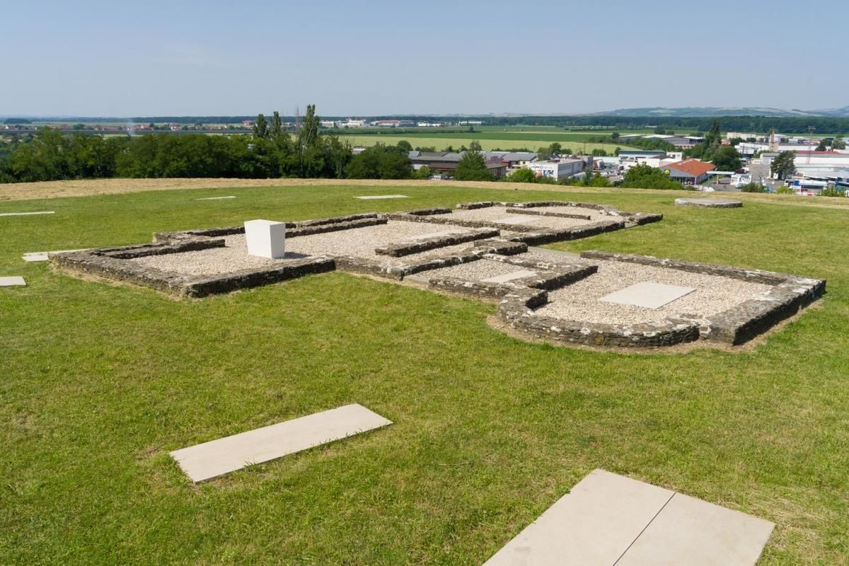
Reconstruction of the church foundations with adjacent graves.
Photoarchive of the Slovácko Museum.
St Methodius’ Hill (also known as Sadská Hill or Metropolitan Hill) is one of the most significant archaeological sites from the Great Moravian period. In the 9th century, it was part of the Staré Město-Uherské Hradiště settlement agglomeration, which some researchers associate with Velehrad, known from written sources. The site is located in the south-eastern part of the town of Uherské Hradiště, on a hill that was once surrounded by the River Olšava. It was discovered by archaeologist Vilém Hrubý from the Moravian Museum, who also carried out extensive excavations between 1959 and 1965. He uncovered several structures dating from the 9th to the early 13th century, including a church with annexes, a cemetery, a large wooden palace-type building, and a log-house settlement from the Great Moravian period. It is believed that this area may have been the seat of Archbishop Methodius and the centre of the “Holy Moravian Church.”
Presumably with the contribution of builders from northern Italy (Aquileia), a church with a cruciform ground plan and a massive quadrangular tower was constructed here as early as the first half of the 9th century. In the second half of the 9th century, a narthex (a church vestibule) was added, followed later by a tomb chamber and a chapel with a separate entrance. To the south of this church complex stood a residential wooden hall over 35 metres long. To the north, there was a log-house settlement with a well, a bakery, and possibly a smithy, while to the west, a smaller rotunda-shaped structure, likely serving as a baptistery, was located.
Among the most significant finds from the settlement and the long hall are the famous lead cross inscribed with the Greek text ZOE-I(ESU)S-CH(RISTO)S-FOS-NIKA (translated as Light-Jesus-Christ-Life-Triumphs), as well as iron and bone styluses used in the teaching of writing. Fragments of glass lamps and other valuable vessels were also discovered, originating from the Frankish Empire and, primarily, the Byzantine cultural sphere of the eastern Mediterranean. A cavity cut into the foundations of the church chancel corresponds to the description of the location of Methodius’ grave found in contemporary written sources and is, thus, considered a possible burial site of Archbishop Methodius. At the centre of the church chapel, archaeologists discovered the tomb of a distinguished man, which, based on its chronology, may have belonged to Svatopluk I, who died in 894.
Even after the decline of Great Moravia, the church and its annexes remained in use. By the 11th and 12th centuries, the area around it had become the largest church necropolis in Moravia, containing more than 870 graves of inhabitants from the surrounding settlements.
References: Galuška 1996; Galuška 1997; Galuška 2001; Galuška 2014; Galuška 2022; Galuška et al. 2018; Hrubý 1970; Staňa 1996.
Navigation point: N 49°3’25.68“, E 17°28‘1.61“ (tourist signpost).


Map notes: The Staré Město-Uherské Hradiště settlement agglomeration. 1 – Staré Město “Na Valách”; 2 – Staré Město “Špitálky”; 3 – Staré Město “Na Dědině”; 4 – Staré Město “Na Kostelíku”; 5 – Uherské Hradiště-Sady; 6 – Uherské Hradiště-Rybárny, “St. Clement” (?); 7 – Uherské Hradiště-Masaryk Sq., “St George´s Chapel”.
Plan of the church complex in Sady. A – church with annexes; B – log structures; C – hall building; D – probable baptistery. Map symbols are available in the Downloads section.


Selected fulltext articles and reports for further reading. Complete bibliographical records are available in the Downloads section as the List of publications.