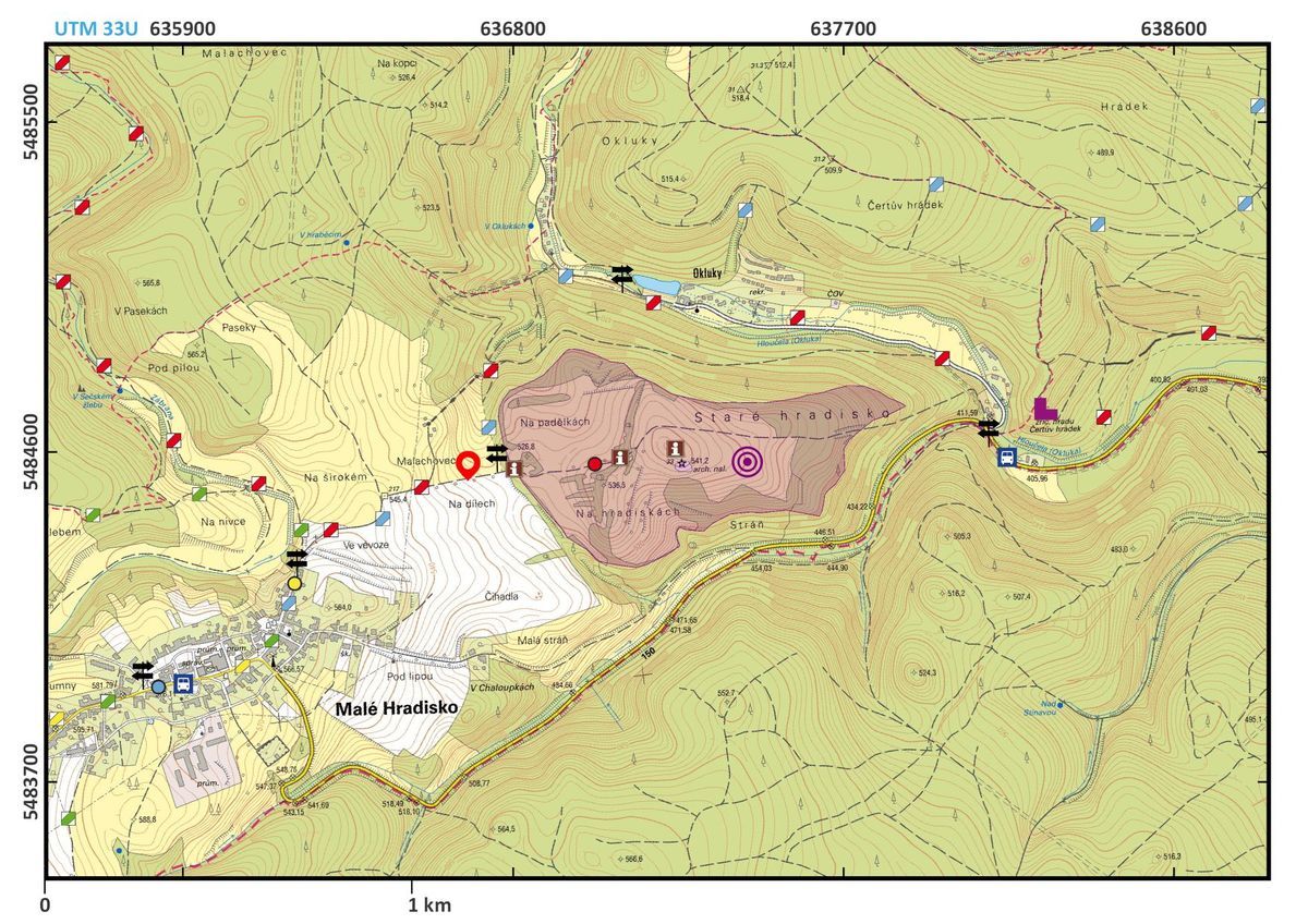
Malé Hradisko, Prostějov District, Olomouc Region
Staré Hradisko, La Tène oppidum
(2nd–1st cent. BC)

Aerial photo of the site; from the west.
Photo M. Bálek, 2001.
This important “Celtic” oppidum is situated on a broad promontory, naturally protected from three sides, at the Staré Hradisko (“old hillfort”) site. It has a strong 2,800-metre long outer fortification enclosing an area of 37.5 ha. The settlement consisted of a central part and two outer baileys while the surroundings of the site were also settled. The fortified area was densely built up with farmsteads of approximately 50 × 50 m, protected with fences and connected with frequently paved paths. The inhabitants specialised in iron production, processed Baltic amber and minted coins. It appears to have been a central site for most of Moravia and controlled the long-distance trade between the Baltic area and Northern Italy. The oppidum has been known since the 17th century and excavations began at the beginning of the 20th century. The first systematic excavation started in the 1930s. The research also shows that the site was occupied in the Final Bronze Age although it is not clear if it had been fortified by then.
References: Čižmář 2002; 2004; Čižmářová 2004; Meduna 1961; 1970.
Navigation point: N 49°29'52.9", E 16°53'08.3" (Malé Hradisko, in front of Staré Hradisko).


Map notes: A – central part; B – western outer bailey; C – small eastern outer bailey; D – gate to the western outer bailey; E – central gate; F – eastern gate; G – north-western gate. Map symbols are available in the Downloads section.


Selected fulltext articles and reports for further reading. Complete bibliographical records are available in the Downloads section as the List of publications.
Čižmář, M. 2002: Keltské oppidum Staré Hradisko. Archeologické památky střední Moravy, svazek 4. Olomouc.Meduna, J. 1961: Staré Hradisko. Katalog nálezů uložených v muzeu města Boskovice. Fontes Archaeologiae Moravicae, Tomus II. Brno.Meduna, J. 1970: Staré Hradisko II. Katalog der Funde aus den Museen in Brno, Praha, Olomouc, Plumlov und Prostějov. Fontes Archaeologiae Moravicae, Tomus V. Brno.